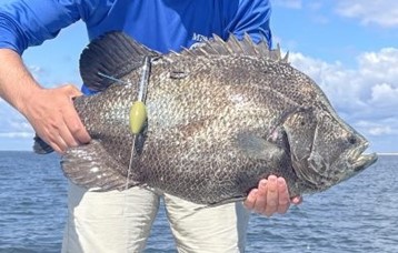
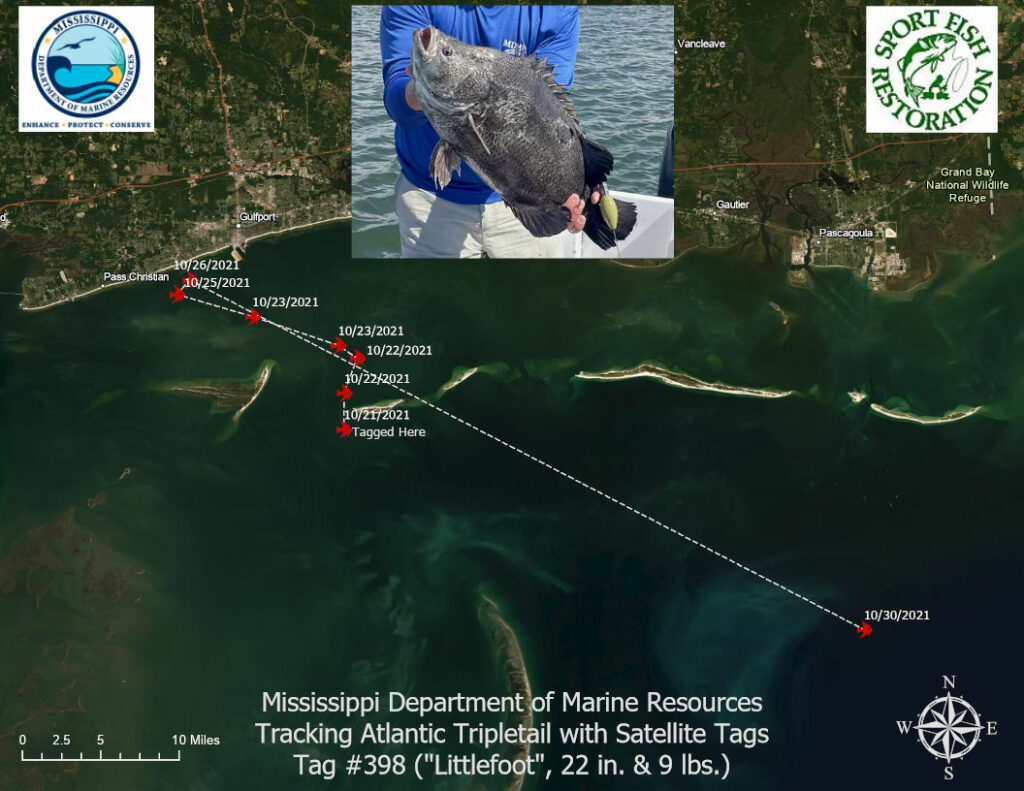
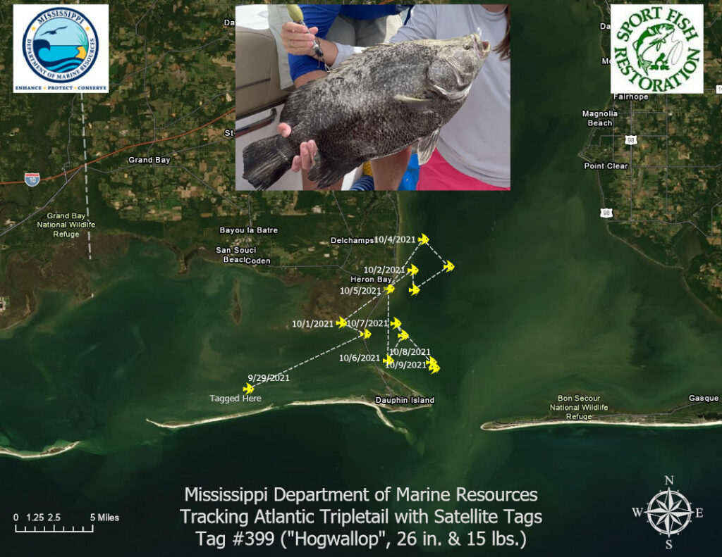
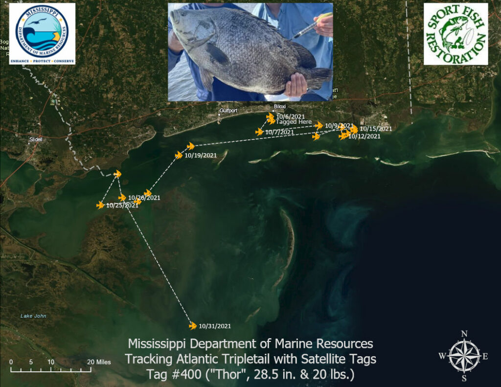
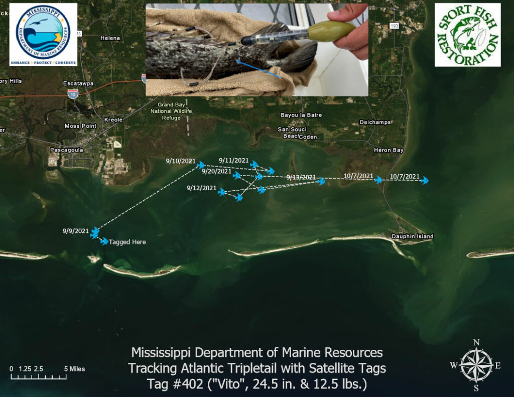
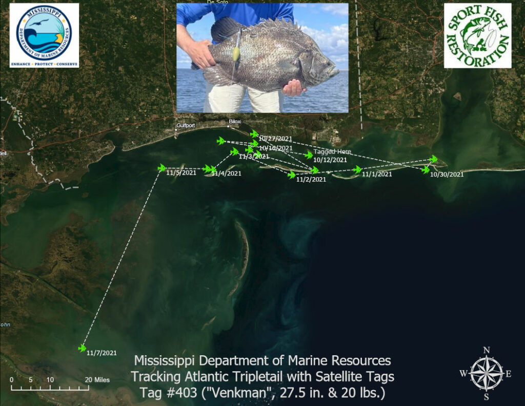
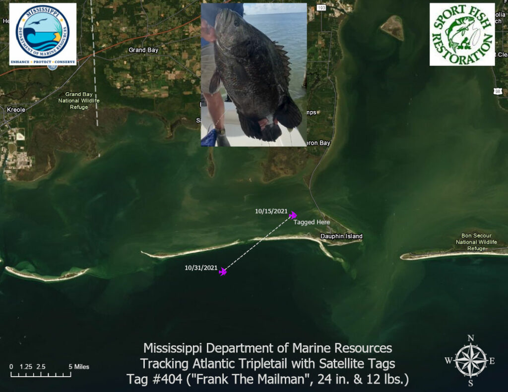
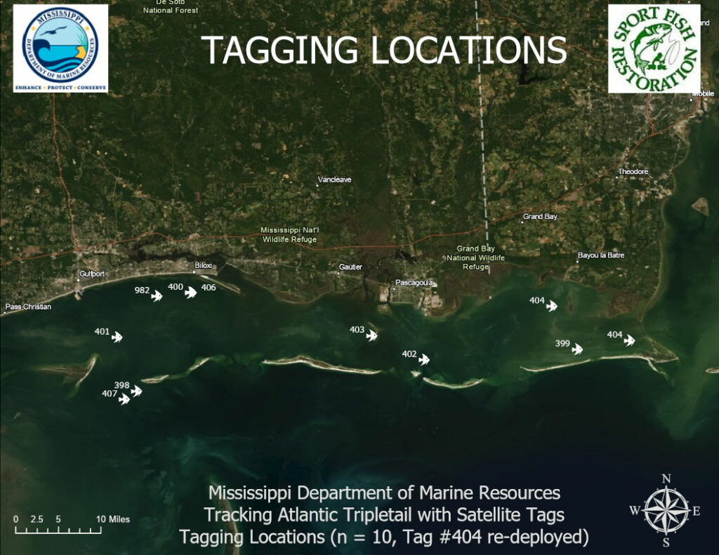
2021 tagging efforts for Atlantic Tripletail were conducted from September 3 to October 21, 2021. Ten fish were equipped with satellite tags. Each of the tagged fish measures between 22 and 31 inches and the tags are intended to track the fish through their winter migrations. The project is being completed through a U.S. Fish and Wildlife Service Sportfish Restoration project focused on studying the movement patterns of migratory sportfish. The project is a first as Tripletail have not previously been equipped with satellite tags in the Gulf of Mexico.
The 2021 satellite tags differ from those used in 2019 in that they can provide real-time locations via satellite communication during deployment. The only requirement is that the fish and the tag must be at the surface when a satellite is passing overhead. Real-time tracks for the tagged fish movements are currently available for six of the nine fish and can be viewed below. Regardless of intermittent satellite communications, the tags will automatically release from the tagged fish in March 2022 and transmit the full archived dataset for analysis.
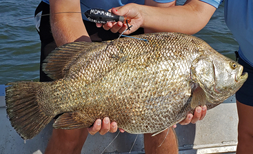
MDMR would like to thank Jay O’Brien of Irish Wake Fishing Charters for his donation of a client’s fish that was caught near Dauphin Island (Tag #404). The fish measured 24 inches, 12 pounds, and at his request has been named “Frank the Mailman” in honor of a late friend and fellow fisherman.
MDMR would like to thank Matt Smith for his donation of the fish he caught near Biloxi (Tag #982). The fish measured 30.5 inches, 20 pounds, and at his request has been named after his fishing team, “Subdude.”
MDMR staff are currently awaiting additional tracking data to include on the next Tripletail tracking update both here and on the MDMR Facebook page.
#TRIPLETAILTHURSDAY
12/09/2021
12/02/2021
2019 TRIPLETAIL TAGGING
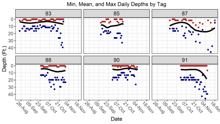
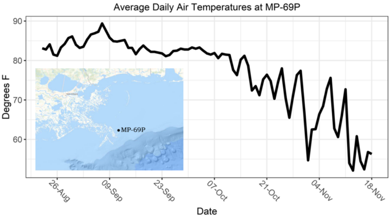
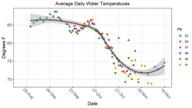
2019 tagging efforts for Atlantic Tripletail were conducted from August 21 to September 30, 2019. Ten fish were equipped with satellite tags, and these were the first Atlantic Tripletail to receive satellite tags in the Gulf of Mexico. The satellite tags recorded light levels, water temperature and depth throughout the deployments. These measurements are compared to known values for sea surface temperature, sunrise/sunset times and depth to calculate a most likely location. The results from the successful 2019 satellite tag deployments are displayed below.